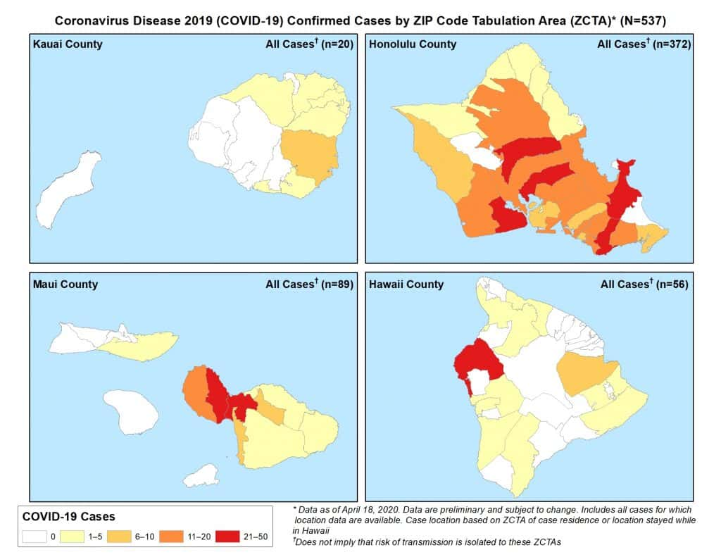
The State Department of Health’s COVID-19 distribution map shows the residences of people who are confirmed to have COVID-19, as of April 19, 2020.
The current map confirms that the cluster of 30 people confirmed to have COVID-19 because they are either employees of or family members of people in the cluster mostly live in the area. People in the cluster work at one or more of the three McDonald’s restaurants in Kailua-Kona (Kuakini at Kalani –Hamburger Hill, at Kona Commons, and inside Walmart) or are family members of workers.
The area in red, per the legend, is 21 to 50 cases of COVID-19. The orange, in Hilo, has between 6 and 10 cases. The yellow indicates areas where there are between 1 and 5 people with COVID-19 living. State Health Department Director Dr. Bruce Anderson stresses that their residence may not be where they contracted the virus.
As of Sunday, April 19, State DOH says there have been 580 cases in the state and 62 cases on the island. Of those 35 people have been released from isolation, so there are 27 active cases on the Big Island.
That means that at least 3 of those who were shown to have contracted COVID-19 in connection with the McDonald’s cluster are no longer under isolation and monitoring by the State Department of Health.
Health officials have said with COVID-19 being a novel coronavirus, with which nobody has experience, it’s not clear how much immunity a victim has once they have recovered.
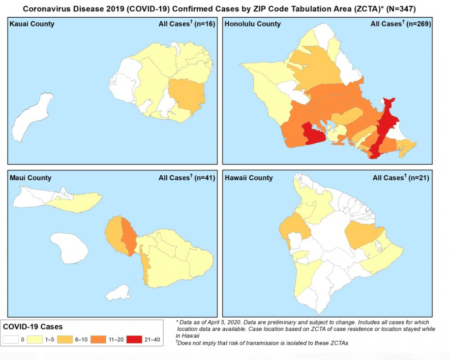
By contrast, here is the map from April 5, 2020, at which time the state had 387 cases and the Big Island was reporting 23.