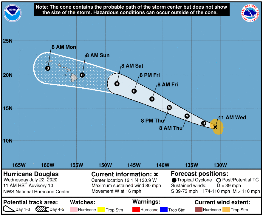
As of 11am HST, the eye of Hurricane Douglas was located about 1,690 miles ESE of Hilo with sustained winds of 80 mph. Douglas is moving west near 16 mph. A turn to toward west-northwest is expected this evening and it is expected to move west-northwest and faster forward speed into the weekend.
Additional strengthening is forecast over the next day or two and Douglas could become a major hurricane on Thursday. Hurricane force winds extend outward up to 10 miles from the center, and tropical-storm-force winds extend outward up to 105 miles. We’ll continue to keep you updated on air and online. Visit www.kwxxweather.com for the latest satellite images and hurricane tracking images.