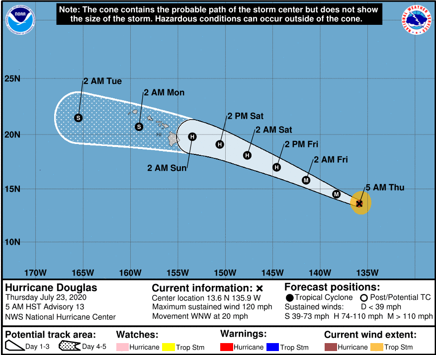
In an early morning update on Thursday, forecasters from the National Hurricane Center and the Central Pacific Hurricane Center stated, “Douglas is expected to move near or over portions of the Hawaiian Islands this weekend and there is an increasing chance that strong winds, dangerous surf and heavy rainfall could affect portions of the state beginning this Sunday.”
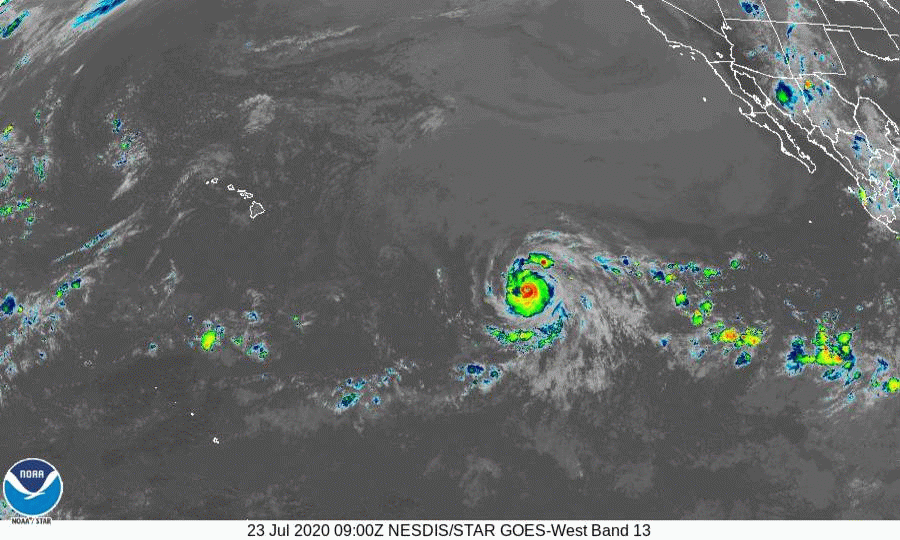
At 5am, the eye of Hurricane Douglas was about 1335 miles east southeast of Hilo and moving west northwest at 20 mph. This motion is expected to continue for the next couple of days with a gradual decrease in forward speed and a slight turn to a more westerly track.
Maximum sustained winds are near 120 mph with higher gusts which makes Douglas at category 3 hurricane on the Saffir-Simpson scale . Some continued strengthening is possible today before a gradual weakening beginning tomorrow.
Hurricane-force winds extend outward up to 30 miles from the center and tropical-storm-force winds extend outward up to 90 miles.
We’ll continue to keep a close eye on the track of this storm and will have updates throughout the day on KWXX 94.7FM Hilo and 101.5FM Kona, B97.1FM Hilo, B93.1FM Kona, KPUA AM 670 and online at www.kwxx.com, www.b97hawaii.com. For the latest weather and hurricane satellite, radar and tracking images, visit www.kwxxweather.com